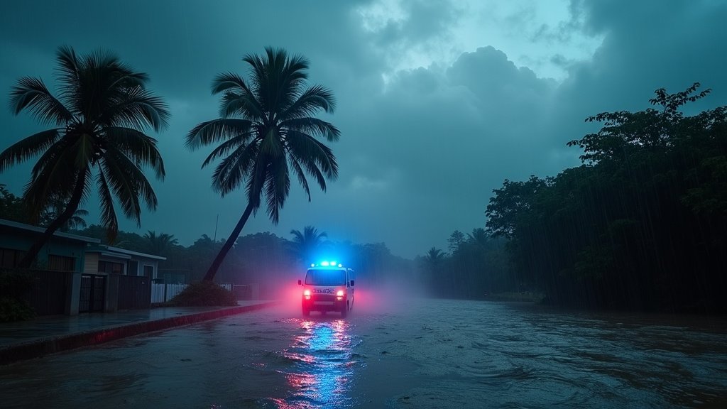
Guadeloupe on Red Alert: Tropical Storm Jerry Triggers Torrential Rains, Winds, and Flooding
Pointe-à-Pitre, Guadeloupe – October 10, 2025 – French authorities have elevated the alert status to “red” for the Caribbean island of Guadeloupe as Tropical Storm Jerry rapidly approached, bringing with it the threat of torrential downpours, powerful winds, and hazardous sea conditions. The heightened alert signifies an imminent threat, urging residents to remain in safe locations and heed official guidance. Nearby Martinique is currently under an orange alert.
This news marks a significant development in the ongoing 2025 Atlantic hurricane season, underscoring the persistent meteorological activity in the Caribbean region. Tropical Storm Jerry, the tenth named storm of the season, formed earlier this week over the central Atlantic. While forecasters at the National Hurricane Center (NHC) indicated that Jerry was projected to pass north of the Leeward Islands and potentially strengthen into a hurricane, its immediate impact on Guadeloupe prompted the highest level of local warning.
Storm Intensifies, Unleashing Fury on Guadeloupe
Tropical Storm Jerry, packing maximum sustained winds of approximately 60 mph with higher gusts, began to unleash its fury on Guadeloupe from Thursday night into Friday. The storm’s approach was characterized by a spiral band bringing persistent and stormy conditions, with Météo-France reporting significant rainfall. Areas such as Saint-François, Le Moule, Sainte-Anne, and La Désirade experienced intense precipitation, with some locations recording over 170 mm of rain within a short period. This deluge led to rapid water level rises on roads and in low-lying areas, causing localized flooding.
Authorities reported that emergency services, including the sapeurs-pompiers, responded to multiple incidents overnight. These included reports of two vehicles being swept away by floodwaters. While one occupant of a vehicle was reportedly rescued, the second vehicle remained unaccounted for in the Le Moule area, prompting difficult search operations due to the challenging weather and flooded terrain. Beyond inland flooding, powerful swells generated by Jerry began impacting the coastlines, with risks of wave overwash and submersion along the southern and western shores. Gusts of wind were reported to reach up to 120 km/h in some affected areas.
Red Alert: Understanding the Imminent Danger
The declaration of a red alert by French prefectural authorities signifies the most severe level of warning. It indicates that a dangerous meteorological phenomenon is imminent or occurring, posing a direct and major threat to the population. During a red alert for cyclones, residents are strongly advised to remain in their homes or designated shelters, avoid all non-essential travel, and disconnect non-essential electrical appliances to mitigate the risk of electrical hazards. Météo-France defines this level as requiring individuals to “stay at home or confine yourself” due to imminent danger and highly probable major effects.
In response to the escalating threat, all schools across Guadeloupe were ordered closed for the day. University classes were moved to a remote, online format, and the university campus itself was unable to open its doors to students. Maritime and air transport services were suspended, including routes to the southern islands and flights to the northern islands, severely disrupting travel and commerce. Numerous public events scheduled for the weekend were also cancelled or postponed.
Regional Context and Broader Storm Outlook
Tropical Storm Jerry is the tenth named storm of what has been an active 2025 Atlantic hurricane season. While Jerry was forecast to potentially strengthen into a hurricane, most models indicated its path would curve northward into the open Atlantic, steering clear of direct landfall on the U.S. mainland. Warnings and watches were issued for the northern Leeward Islands as the storm passed nearby. However, the direct impact on Guadeloupe through heavy rainfall and strong winds underscored the localized and often unpredictable nature of tropical weather systems in the Caribbean.
The NHC had indicated that Tropical Storm Jerry, with sustained winds of 65 mph as of October 9, was moving northwest at 17 mph. Its projected trajectory was near or northeast of the northern Leeward Islands, with the potential for two to four inches of rain, and local maxima up to six inches, across the Leeward and Virgin Islands. This rainfall alone carried a significant risk of flash flooding, particularly in urbanized areas and regions with steep terrain. Swells generated by Jerry were also beginning to affect the region, raising concerns about dangerous surf and life-threatening rip current conditions along the coasts.
While the immediate focus was on Guadeloupe, the broader regional news highlighted the interconnectedness of weather patterns. The influence of a developing nor’easter off the U.S. East Coast was contributing to steering Jerry away from the American coastline, but the proximity of these systems also illustrated the dynamic nature of the Atlantic basin during hurricane season.
Lessons from Past Storms and a Call for Vigilance
The response in Guadeloupe draws on lessons learned from previous significant weather events. The French Caribbean is no stranger to the destructive potential of tropical cyclones, with past storms like Hurricane Fiona causing widespread disruption and damage. Preparations for Tropical Storm Jerry involved measures commonly recommended for such events, including securing homes, stocking up on essential supplies like water and non-perishable food, and staying informed through official channels.
As of Friday midday, weather conditions were anticipated to begin improving. However, authorities continued to urge the utmost caution. The red alert remained in effect, emphasizing that while the most intense phase might be passing, residual risks from heavy rains, flooding, and strong sea conditions persisted. The government urged residents to stay informed via Météo-France bulletins and follow all instructions from emergency services. The experience served as another reminder of the importance of preparedness and responsiveness in the face of powerful tropical weather systems that frequently affect the Caribbean region.

